
Comparative opening — choosing clarity over buzz
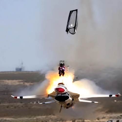
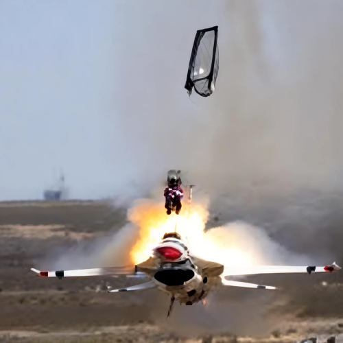
When a team builds a digital twin, they often start with maps from UAV surveys and assume that geometry alone will answer operations questions. A different path adds temporal detail: high-speed capture that reveals micro-motions, impact events, and transient loads. For teams weighing those paths, the tradeoffs are concrete — spatial resolution versus temporal fidelity — and one pragmatic bridge is high speed motion analysis that feeds dynamic behavior into the twin. The comparison sets the scene: rate of data capture, synchronization complexity, and downstream analytics capacity determine whether you get a model that only looks right, or one that behaves right.
Where UAV mapping leads
UAV mapping delivers large-area context, consistent georeferencing, and photogrammetric accuracy. It gives you millimeter-to-centimeter geometry across landscapes, buildings, and infrastructure. Frame rate isn’t relevant here; instead terms like orthomosaic, ground sampling distance, and tie-point accuracy matter. Use UAV surveys when you need stable surfaces, change detection over weeks or months, and a clear baseline for construction or asset inventories.
Where high-speed imaging changes the game
High-speed systems capture events that happen in milliseconds: collisions, mechanical vibrations, or rapid actuator motion. Industry terms like frame rate, exposure, and motion blur are central — modern setups run from hundreds to thousands of fps to resolve cause-and-effect. These systems support target tracking and low-latency telemetry so a digital twin reflects not just shape but behavior. A practical anchor: Major League Baseball’s tracking tools and stadium labs use high-speed optical tracking to measure pitch and bat-ball interactions — showing how high fps data yields new metrics for performance and safety.
Integrating aerial maps with high-speed capture
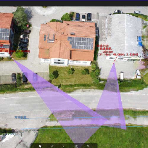
Combine broad UAV geometry with local high-speed rigs to make a hybrid twin. The workflow looks like this:
– Register UAV photogrammetry to a shared coordinate frame (GCPs or RTK).
– Place synchronized high-speed cameras or sensors at points of interest and capture events with known timestamps and calibration targets.
– Fuse motion traces into the spatial mesh so transient displacements, accelerations, and strain map back to physical locations. This requires attention to synchronization, lens calibration, and exposure control to avoid motion blur — but when aligned, you get a twin that supports both inspection and incident reconstruction.
Common mistakes and practical alternatives
Teams stumble when they treat temporal capture like another photo sweep. Typical errors include inadequate fps for the event, poor synchronization between devices, and relying on single-camera views for 3D motion — which introduces parallax errors. Alternatives or mitigations include multi-camera stereo rigs, event-triggered recording to save bandwidth, and edge pre-processing to reduce latency. For simpler needs, high-frame-rate photogrammetry at moderate fps can substitute for true high-speed rigs — but recognize the limit: exposure and motion blur still govern the quality of motion vectors.
Cost, complexity, and where each method pays off
UAV mapping scales cheaply across terrain; high-speed capture is more expensive per point but essential where milliseconds matter. Evaluate along three axes: data volume (GB/h), processing latency (seconds-to-hours), and actionable insight (static geometry vs. dynamic behavior). If your objective is automated defect detection in a conveyor line or capturing impact mechanics on a prototype, invest in synchronized high-speed imaging and target tracking. If you need asset inventories or topographic monitoring, prioritize UAV campaigns and dense point-cloud workflows.
Advisory — three golden metrics for choosing tools
1) Temporal resolution (minimum fps needed): pick systems with 2–3× the frame rate of the fastest event to reduce motion blur and maintain reliable motion vectors.
2) Spatial registration accuracy (mm or cm): ensure your combined workflow keeps error budgets within the tolerance of the analysis — for crash reconstruction that’s often millimeters; for site planning, centimeters suffice.
3) End-to-end latency (capture to usable signal): measure the time from event to insight. Lower latency matters for control or automated responses; higher latency is acceptable for post-event forensics.
These rules steer procurement, tests, and day-to-day choices — and they show why a product that supports robust synchronization and target tracking simplifies integration. —
Bringing both sides together lets teams answer new questions about safety, performance, and life cycle. For projects that demand both context and micro-second detail, the value lands in practical systems that combine accurate georeferencing with reliable high-speed capture. Icecypress Technology. —